The Middle San Pedro: Benson Sub-area
[ From Near Fairbank to The Narrows ]
Click on the map to enlarge it

In this part of the drainage, the main flanking Sky Islands are the Whetstone Mountains and the Dragoon Mountains (both of which are mostly National Forest land). The Little Dragoon Mountains lie mainly to the north of the I-10 freeway. As you can see on the map, two substantial paved highways, AZ State 90 and US 89, run north-south paralleling the river corridor on each side. These are both high-speed motorways and therefore constitute significant barriers to between-mountain movements by terrestrial vertebrates.
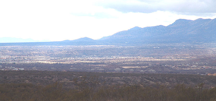
Below: looking southeastward toward the Mule Mountains (and the location of Bisbee) from near Fairbank, Arizona: gallery forest of the Babocomari Stream drainage in the foreground, running from lower right to middle-left; San Pedro River Cottonwoods et al. in the farther distance, both rivers running from right to left. (July 2002) This image, which looks from the southern edge of the Middle San Pedro out into the northern portion of the Upper San Pedro, illustrates the very broad width of the valley south of Benson.
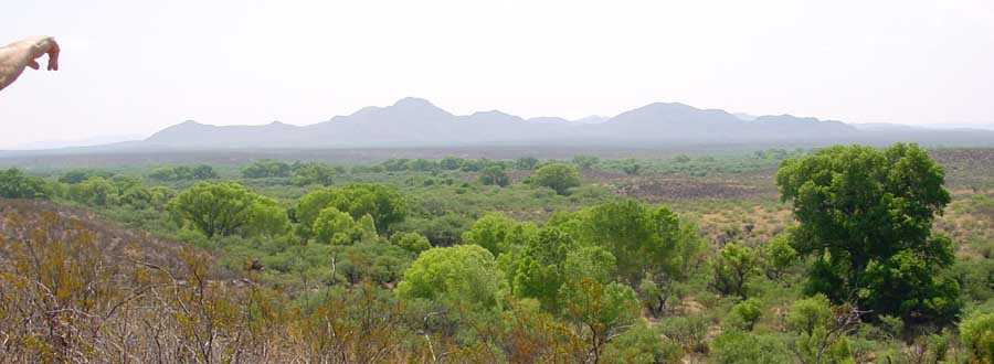
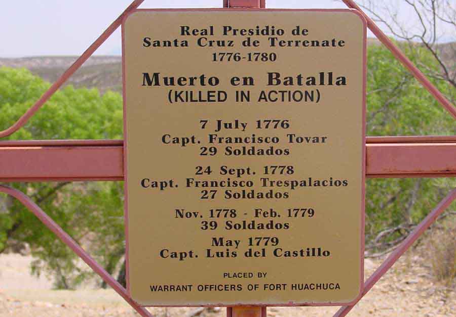
Below, the broad San Pedro River floodplain photographed (looking north) from a nearby location at the terrace site of the ruins of Santa Cruz de Terrenate, the Spanish Fort built here in 1775. (See that link for a brief history of this fort.) Archaeologist T.J. Ferguson (at left here) led our tour on July 17, 2002:
Thanks to T.J. and his colleagues, a diagram reconstructing the fort's layout:

As you can see, this complex was a substantial, high-walled enclosure (complete with both chapel and diamond-shaped bastion intended for cannon emplacements), a presidio which the Spaniards founded as a permanent base for subduing roving predatory Apache bands who were then dominating the area. Unfortunately for these medieval-fortress warriors, the Apaches routed them using guerrilla tactics without loss to themselves, forcing the Spaniards to abandon the entire post after only 4 years. (Note below left in the foreground of the photograph (taken from the eastern fringes of the fort), the railway, which dates from the 1880s mining era, and the river floodplain a short distance beyond it.) (Click on each image to enlarge it.)
 ..
..
Further north, the western bajadas of the San Pedro River south of Benson stream out of the Whetstone Mountains in long straight lines of alluvium (see the image below, where the central horizontal strip marks part of a very long bajada). This photo also nicely shows the tilted fault-block shape of these Basin-range mountains: (Click on the image for a closer view.)
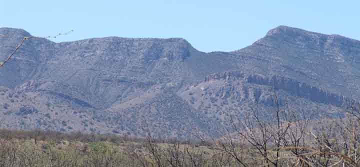
The picture above was taken from Kartchner Caverns State Park April 17, 2005, looking from the other side of the bajada toward the southwest, where the escarpment tilts down from its apex toward the west. Note the close grass cover in the foreground, part of the Apache Highlands Grasslands. An informative video presentation of the geological and hydrological history of this part of the San Pedro River Valley may be viewed at this link: Kartchner Caverns Hydrology. And see Whetstone Mountains for more details on this, a lesser (but by no means insignificant) Island in the San Pedro Valley portion of the Madrean Sky Island Archipelago. See the link just listed for more details on Island-Corridor relations here.
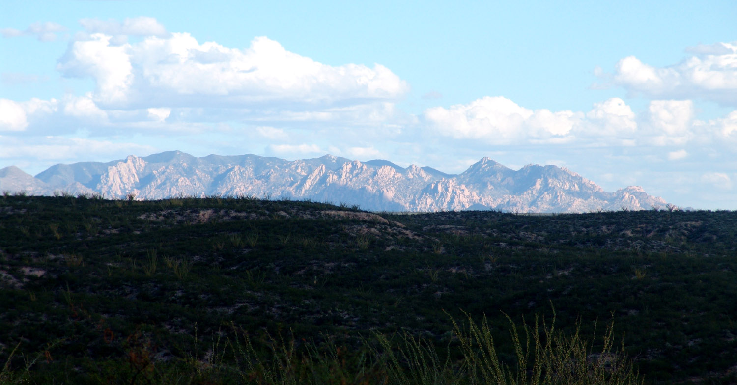
Below, a view of the Dragoon Mountains taken from the hills above Tres Alamos Wash on the San Pedro in August 2007, looking east-southeast. A complex mix of intrusive granitic rocks and faulted/folded metamorphosed sedimentary rocks, these mountains rise abruptly from their grassland plains and contain much chaotic terrain. This range rises up in an important part of the Apache Highlands and is an important part of Apache Indian history as well. See the "Dragoon" link above for more details on Island-Corridor relations. (Click on the image to enlarge it.)
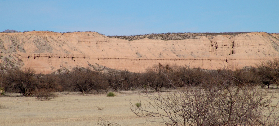
Below: the "pink cliff" terraces that surround Benson, here viewed from the west-side terrace in the afternoon of October 26, 2008 looking east across the San Pedro River floodplain with the Little Dragoon Mountains in the background. (Note the multi-lane US I-10 Freeway rising over the terrace just right of mid-picture.) (Click on the image below to enlarge it.)

These pink cliffs are sedimentary remains of the St. David Basin Lake of Pliocene times: (before the Gila River captured the San Pedro Valley basins, which had previously contained several interior-basin lakes). Below, a closeup view of these old lakebeds from near the base of one terrace:
The sediments originally deposited in this very extensive lakebed (see the "silt and clay" layers in the cross-section dispayed in the USGS diagram above) consist of as much as 900 feet of clays, silts, and freshwater limestone, and they tend to confine the vertical movement of ground water in the basin, creating aquifer conditions that sustain the distinctive artesian wells found near the town of St. David. (See Thomas Blakemore, above and cited in Geology Credits.) These have of course proved advantageous to farmers here, who have settled the area since prior to the 1880s.
The city of Benson lies on the western edge of the river, and forms the main vehicular intersection of the area. The map below shows Interstate Highway 10 running east-west past the city, dropping from an Apache Highlands Grassland terrace elevation of more than 4160 feet to the west down to 3500 feet at the river crossing. The highway then rises in altitude toward the east, reaching 5,000 feet elevation at the Texas Canyon summit.
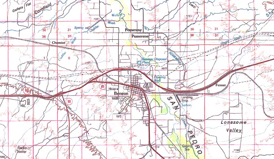
The largest city in the Middle San Pedro Watershed (with a population of ca. 4900 in 2005), Benson was established in 1880 when the Southern Pacific Railway made its San Pedro River crossing (the city name is that of a friend of the Railway's President at the time). Its numbers might well increase to more than 50,000 by 2025. San Pedro River groundwater is its primary source of water and hence anticipated increases in groundwater pumping will soon threaten quality of life around here (including riparian habitat). Sources of decline in streamflow of the San Pedro River here also include changes in upland land-cover and riparian vegetation. Quality of water remains good for domestic, governmental, and commercial uses (though there a 9-square mile area of contaminated ground water just SW of St. David (now designated as an EPA Superfund site). [See Blakemore cited above]. As in the St. David area, the basin fill around Pomerene contains clay deposits from the ancient lake, so artesian wells are found here too, and these are much used by local farmers.
The Town of Pomerene
On the map below, the black arrow at the top indicates the location of the Cascabel Road, the main roadway down the river valley, which stays on the east side of the river all the way north past Redington. (Another road follows the west bank, but it ends well south of Cascabel.) The Pomerene Road becomes the Cascabel Road about 5 miles north of the I-10 exit.
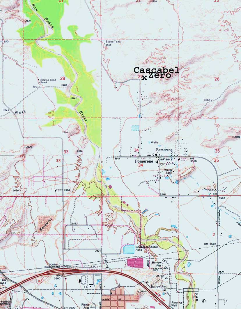
This hamlet, still substantially a farming community, is partly occupied by descendants of the Mormon Battalion, a nineteenth-century branch of the Iowa infantry mustered in 1846 during the Mexican War, whos soldiers marched up the San Pedro River on their way toward Tucson (then part of Mexico) and encountered the environmental wonders of the place. Near the Benson Narrows, they were accosted by a herd of stampeding wild cattle, with the reported result of ten to fifteen bulls killed, two mules gored to death, and three men wounded. (see "The Battle of the Bulls", which includes this beautiful picture taken somewhere near the site of the battle (south of the Narrows): [Thanks to The Religious Education Image Archive, accessible at the link just provided.)

We mention this event to make the historical point that, as Webb, Leake, & Turner observe in their monumental book The Ribbon of Green (U. of Az Press 2007), the episode reflected the introduction of large herds from Mexico by homesteaders in this area after 1832, which was followed by intensive raiding by Apache bands, causing the homesteaders to abandon their large ranches around 1840. Since the Apaches selectively culled cows, the large wild herds that remained in this area at the time of the Mormon Battalion were almost entirely bulls -- a very dangerous herd of wild animals indeed. (Webb, Leake, & Turner note that they were gone from the area by the 1850s. See p.223 in that source.)
We hope to insert more history of Pomerene into this space as becomes feasible, and would of course welcome Pomerenians to contribute credited essays to it.
Below, a view of the Benson/Pomerene valley taken in January 2007 from the top of a "pink cliffs" terrace located to the northeast along Cascabel Road, looking southward. The center of Benson lies roughly in the center of the image. Note the very broad bajada slope behind the city running from the flanks of the Whetstone Mountains at the right all the way out of photo to the left. The river crosses the image laterally, running from south-southeast toward the lower left to north-northwest at lower right. (Its course is roughly visible in the scattered cottonwood trees running along it, whose seasonally gray crowns stand out from the darker background.)