Ecoregional Features: Tres Alamos North
Beyond the Grand Cuts shown above, the road turns north-north-westward as you go downstream and drop down toward the River.
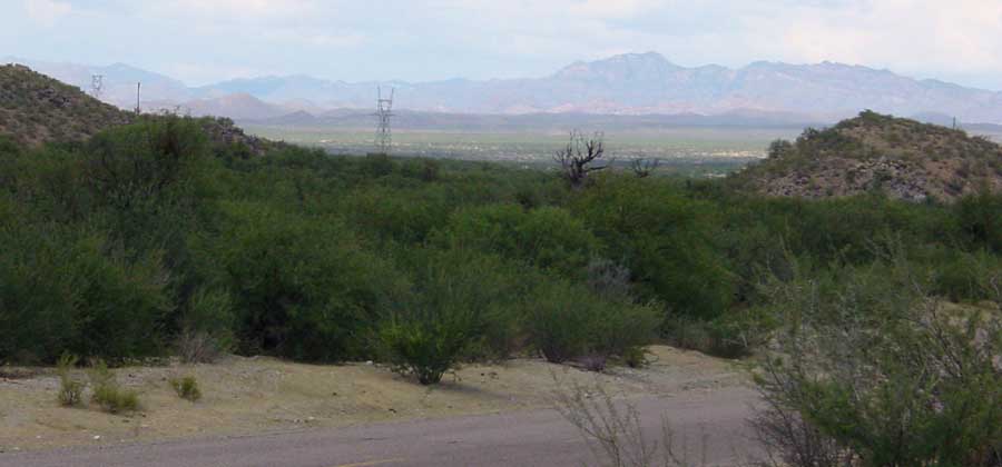
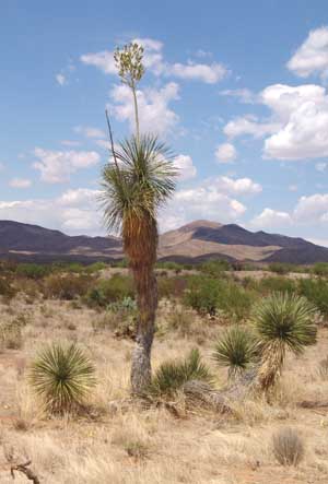 The old terrace flanking the Tres Alamos Wash displays a fine array of plants typical of the
Chihuahuan Desert Ecoregion. Yucca elata (at left) are very prominent here, and they may be seen all the way downriver to Cascabel, though at that location they become limited to the river floodplain and near vicinity, while Yucca baccata replaces
them in the uplands. Click on the image to enlarge it.
The old terrace flanking the Tres Alamos Wash displays a fine array of plants typical of the
Chihuahuan Desert Ecoregion. Yucca elata (at left) are very prominent here, and they may be seen all the way downriver to Cascabel, though at that location they become limited to the river floodplain and near vicinity, while Yucca baccata replaces
them in the uplands. Click on the image to enlarge it.
Yucca species and their relatives are important indicators of eological conditions as well as valuable plants in their own right. For more on the subject, see The Agaves and Nolinas. For a broader reference guide to the vegetation of the area, see San Pedro Valley Flora: Today; for a comparison in deeper time perspective, seeSan Pedro Valley Flora: in the Pleistocene.
Note also the Desert Grasslands filling the ground in the image at left. This area is also considered part of the Apache Highlands ecoregion.
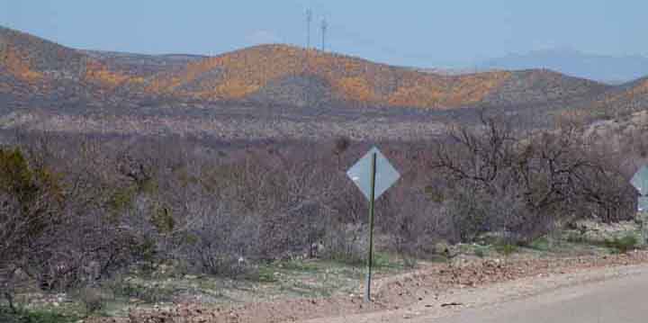
In March 2005, the gray hills of the Little Rincons foothills which approach the River at this point, below, were covered with Spring Poppy blooms.
A newcomer to the area may sense the diversity of wildflowers in our area by consulting the following link: Wildflowers.
The Middle San Pedro: Redington Sub-area
[ from the Narrows to the Redington Bridge Gaging Station ]
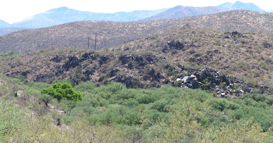
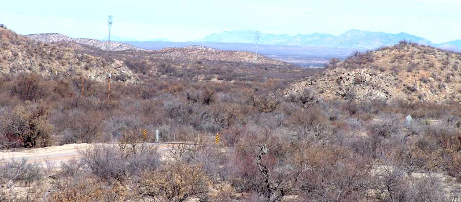
Below, see the Narrows -- or the "Benson Narrows", a sub-watershed designation that distinguishes it from the Narrows further downstream near Redington (see further below, the "Redington Narrows"). This Narrows (note the distinct rock-outcrop "edges" at both left and right) marks a geological (and hydrological) boundary between the upstream portion of the River and the part located further downstream. This view of the Narrows is from the downstream side looking toward the southwest. (May 2007)
Note in the image the distinctly riparian tree in the lower left, standing out among a stand of mesquite trees. Note also the strongly ascending slopes of the uplands beyond the west bank of the river here, uplands that rise to the nearby peak named Whitehorse Mountain in the Little Rincons. This tree marks the forcing of groundwater to the surface by the impermeable underlying rocks.]
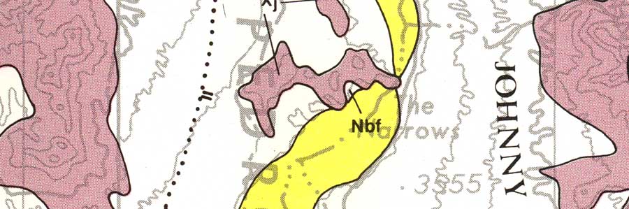
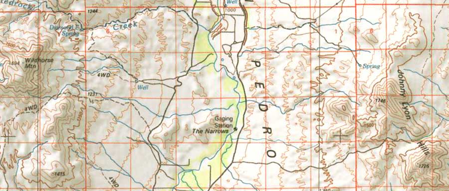
The basis of this hydrogeological separation lies in these distinctive rocks, which are part of the "Johnny Lyon suite of granodiorite... which may form a single composite pluton" forming the geological basement of this area, and which extend under the Narrows. These rocks are some 1.65 Billion years old. (Map below and text adapted from Dickinson's monumental work of 1991. The yellow Formation shown below is contemporary floodplain alluvium, while the rosy-brown color marks exposures of the Johnny Lyon suite. The white marks massive terraces of roughly Quiburis [7.5-5.5 Mya] age.)
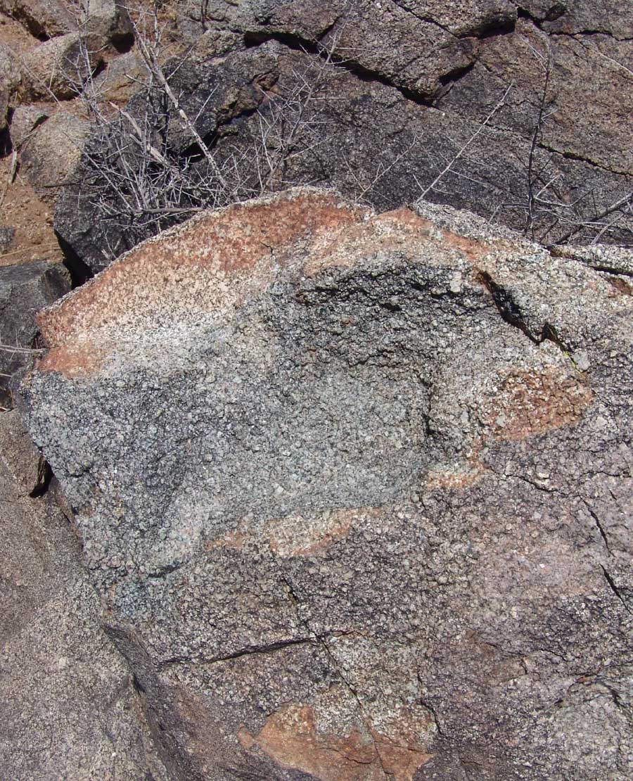
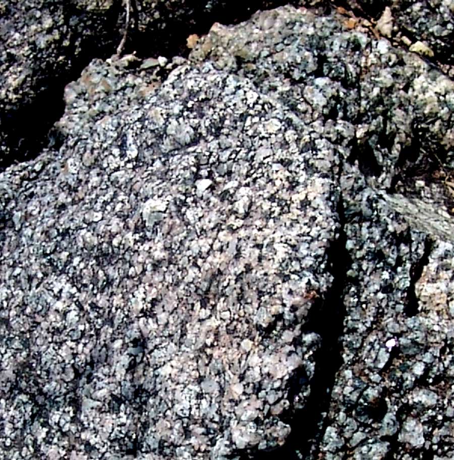
A few images of these extremely ancient rocks are perhaps in order. Below, an outcrop along the eastern hillside of the Narrows:
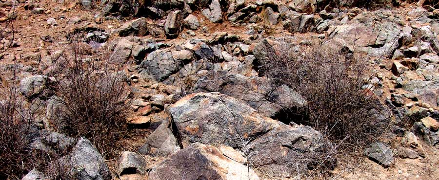
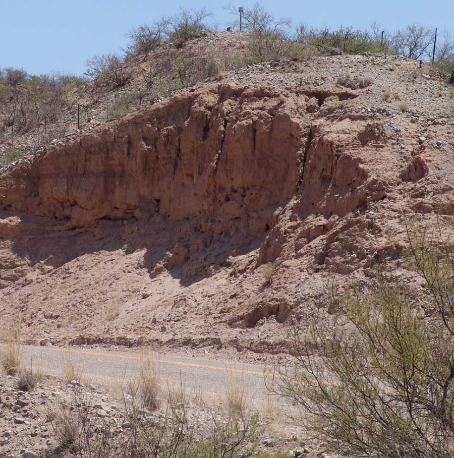
Below left, a closeup view of one of the rocks; below center, the crystalline structure of the granodiorite; below right, in contrast, the much more recent St. David Lake-bed Formation that overlies these basement rocks, visible just across the Cascabel Road at this same location. (Click on each image to enlarge it.)
 ..
.. ..
..
These two images of the Benson Narrows below are from August 2002 (left) and January 2005 (right), both looking downstream through the Narrows from viewpoints just east of the Cascabel Road. In both images, Bassett Peak of the Galiuro Mountains is framed in the distant background --near the center horizon in the left image, and well to the right in the right image. In the left-hand view, taken from further upstream, Sierra Blanca is just visible in reddish brown behind the left edge of the Narrows, while in the right-hand view the image is pointed in a more northerly direction and is taken from a slightly higher hill. Click on each image for a closer view of the Narrows gap and the valley-&-Sky Island country beyond:
 ..
..
Ecological Richness of this Sub-Area
From this point northward, we enter the Redington Sub-area of the Middle San Pedro Watershed. (See map.) Over a four-mile stretch of the River straddling the Benson Narrows, the riverbed drops about 40 feet, a hydrological change where deep valley fill upstream encounters this bedrock outcrop that forces water to the surface.
Early 19th-century explorers reported that below the gorge at this point, the then-perennial stream spread out over the lower floodplain, forming sporadically extensive swamps running all the way past Cascabel and containing beaver dams and large fish. For more on the history of this area's hydrology, see Cienegas. From the Narrows northward to Redington, the aquifer is narrower and thinner than that to the south, and for most of the area it lacks the clay beds found further south that confine the groundwater (though in several locations water still rises to the surface).
Below, a map of the Narrows showing its location relative to the Cascabel Road. The rock formations that straddle the Narrows are ancient (structurally similar to those of the Johnny Lyon Hills], but those bounding the roadway are much more recent, lakebed formations connected with the Pliocene St. David Formation further south. (Note the springs on each side of the watershed.)
Side-Page: the Johnny Lyon Hills
Below: Fremont Cottonwood/Goodding Willow Gallery Forest marks the zig-zag San Pedro River channel near the 3-Links Farm near Milepost 13 (October 2002):
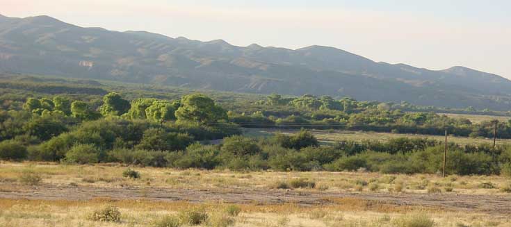
Today, the entire river basin contains long strips of this Cottonwood/Willow riparian gallery forest, which is one of less than 20 such riparian zones in the world. This forest sustains a highly diverse wildlife, including large numbers of migratory birds and a variety of vegetation forms. For a quick take on our birds, click on this link, and for a description of the typical riparian vegetation of this zone, click again on San Pedro Valley Flora Today, and scroll down to (4) Streamways.
Below: at the 3-Links Farm, the river becomes a perennial flow for a considerable stretch (cattle have been fenced off the immediate floodplain here for many years). When this picture was taken in February 2003, Dace were spawning in the streambed. Here we're looking upstream.

Recently, The Nature Conservancy bought this 3-Links part of the River, and ceased the agricultural pumping of river water (formerly done to grow alfalfa), and over several years the perennial stream has expanded more than a mile in length (though this varies depending on drought intensity).
For more information and images showing the biological richness of the River along this 3-links stretch, see this side tour, well worth taking, which shows a region as rich in biodiversity as (and in some ways richer than) the federally-designated SPRNCA of the Upper San Pedro Area discussed elsewhere in this account.
The Nature Conservancy 3-Links Tour, April 2005