Further Commentary on The "Grand Cascabel Roadway"
A former member of the ADOT, recorded by Anna Lands at the Cascabel Working Group meeting on June 21st, 2007, said (referring to what our web page now calls the old "Grand Roadway") words roughly to this effect (see her for reference to her notes): Thirdly, when the plan of the 1960’s-70’s to build a road to San Manuel was abandoned, it was abandoned because of drainage issues. The newly established EPA’s requirements rendered the plan untenable. Tres Alamos and Redington bridges were built and that was the start and end of that project. The drainage issues remain.
We who love Cascabel know that everyone owes the present relative wildness of the Cascabel portion of the San Pedro River Basin to the fact that the project was not completed at that time, since a road of this caliber of "creative destruction", though at the time conceived to be only two-lane, would surely have been thoroughly paved, and Cascabel would by now be a bedroom suburb of Tucson (not to mention drastically transformed from a wildlife point of view). But it appears that like Frankenstein, versions of this plan to "pave paradise" refuse to die -- witness the current ADOT study with which we are concerned. As represented on our main page, while Alternatives "A", "B", "D", & "J" would perhaps now offer less colossally expensive routes at their most southerly ends (as shown here), this hypothetical concession would not apply to Alternative "K" (marked in blue on the maps provided there)), which would magnify several diopters worth of construction beyond what you have seen in the Grand Cut and Bridge images just emplaced above). And in any case, all of these alternatives converge in the Central Core further north (see the main page), where constructions would become much more Frankenstinian than anything so far created along the Grand Roadway.
Some Low-Ground Details
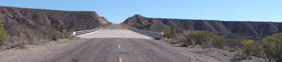
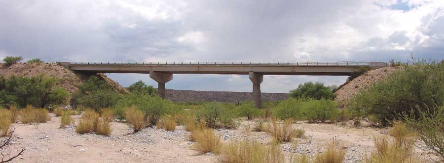
Only by approaching the roadway from beneath, that is from the position of the Tres Alamos Wash which it overruns, can we see the true expense that this construction entailed.
Below, massive pillars stand in mid-wash, supporting a very extensive span. Flanking them, the ramps which embrace and constrict the wash.
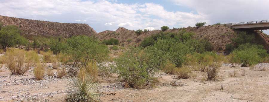
Below, the south ramp, employing no doubt materials from the Grand Cuts but some other materials as well.
Below, the north ramp, whose grounding materials would perhaps largely come from elsewhere.
Aside from the expense of construction, these great side-dams significantly alter wash ecology. Our point here is not that the change to be explored here is necessarily good or bad -- we do not know. But the fact is that the ecological changes were largely unintended, unconsidered, indeed (to the planners and builders) probably for the most part unimagined, and they are without question real.
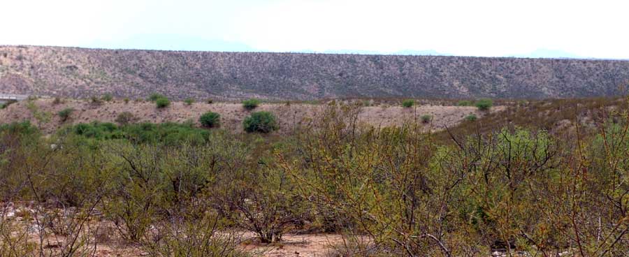
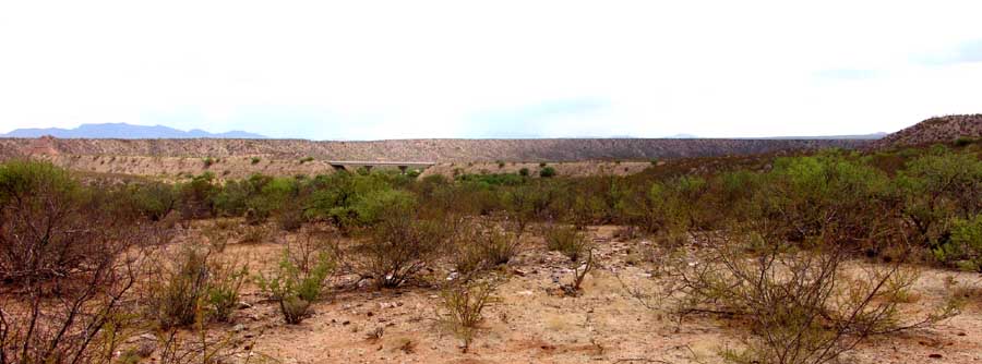
Below, the view of this whole twentieth-century operation seen from the second terrace of the post-Quiburis (<7.5-5.5 Million years ago) wash. The high terrace at horizon view is composed of remains of Quiburis deposition. The first terrace is out of view below to the left, just above the floodplain. The north ramp of this Grand Bridge system merges with the third terrace at mid-right in the image.
Our point in bringing this to you is not to bemoan the presence of this great, impressive Destructive Creation. The point is that further downstream, this kind of earth-and-concrete-and-steel works (necessary changes being made by the technologically adaptable and creatively powerful builders), extended into the Redington Sub-Area of this magnificent river system, will wreak real havoc in the narrower, more intensely dissected, and -- yes -- biologically richer locations there.
And yet, quite thoroughly concealed within this very location from those obsessed with grand vistas are other options, a different kind of roadway Alternative that we would like the ADOT to consider and indeed would urge them to pursue (existing balances of State funds permitting). For that potential improvement, see this Side-page:
Side-page:The Grand Cut's Old Road: Revive it as a Nature Trail?