The Happy Valley - Paige Canyon Corridor and an I-10 Bypass

On the map at left, Happy Valley is located directly to the west of the D label and lies in the obvious basin visible just east of the Rincon Peak complex with its north-south-running Martinez Fault escarpment. Its eastern side is broken by the Pima-Cochise Counties boundary shown by the dotted line.
Obviously, Happy Valley is not directly threatened by the routing of Alternative D as it is currently indicated, but indirect affects of an Interstate Highway here should be considered.
In the map below left, the current I-10 Interstate runs east-west along the bottom and two Interchanges are evident: toward the left (west, near the Pima County Line), 297 (the "Mescal Road" Interchange), and just right of center, 299 (the "Skyline Interchange"), each of these marked in red numbers (click on the map to enlarge it):
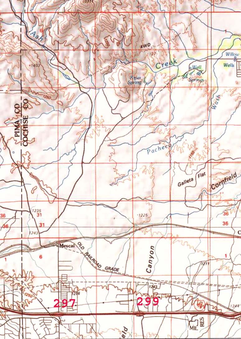
Alternative D is marked as departing at 299, the Skyline Interchange. All of the land along the north side of the I-10 corridor is private land to a point somewhat north of the "Old Railroad Grade". (Click on the map image to enlarge it.)
The Alternative runs north, presumably to a point near the Pacheco Wash (at mid-map), than angles northeast past the now-occupied subdivision shown near the edge of the right-upper corner of the map, where it connects to Ocotillo Road to run further north along the west banks of the San Pedro.
For further details on the route just outlined, see
Side-Page: Skyline Interchange-0cotillo & Alternative D
Our interest here however is in the relationship of this Alternative Bypass to potential developments involving the Ash Creek Canyon and eventually Happy Valley.
From the Mescal Road Exit (297), Mescal Road runs north at an elevation of about 4,000 feet past a bustling subdivided settlement of trailers and small businesses located near the off-ramp, before crossing the Southern Pacific Railroad tracks and passing by the closed community of Mescal (founded and still operated as a working Movie ranch)
It then trends northeastward through mostly (but not entirely) State Land and then turns north to northwest up Ash Creek Canyon at far upper-left on the map above.
Happy Valley: Headwaters of Paige Canyon Corridor

Happy Valley is important wildlife habitat, but it is also highly vulnerable to development. Dirt road and remoteness protects it somewhat for now, but construction along proposed Alternative D here would be followed by development of "gas cities" in the bajada below, and Happy Valley, with its considerable amount of private land, would become attractive to bedroom commuters. Ash Creek Road would be paved, and the suburbanizing consequences would follow.
