From Milepost 31 to the Redington Narrows
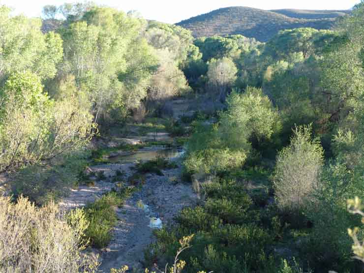
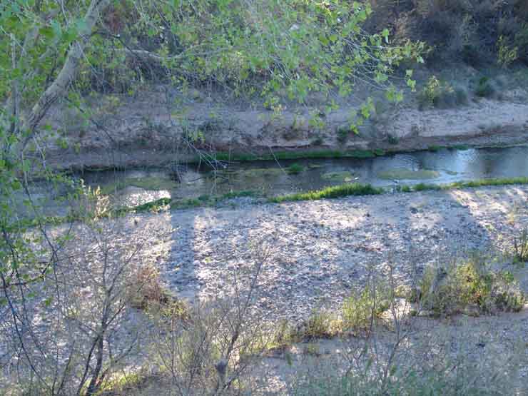
At Milepost 31, the cottonwood/willow gallery forest stands out in another stretch of perennial stream, shown in April 2005 below, first looking upstream and then (at right), looking across: (click on each image below to enlarge)
 ...
...
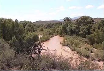
Between Milepost 31 and 32, the road runs past the Redington Narrows, shown at right below when the river was running in flood in August 1998. (the photo at left was taken on the same day near the location shown above.) (click on the right-hand image below to enlarge it.)
 ...
...
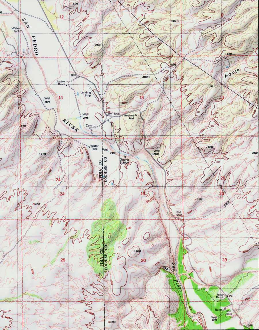
Below, this map shows the Narrows near dead center, with a Gaging Station marked as located in the midst of it. The two arms of the Narrows, pointed toward one another in a northeast-southwest orientation, are clearly visible here. Assuming an Interstate Highway running near the floodplain here, considerable blasting would be required to enlarge the roadway that swings north away from the floodplain at this point. (See images of the "Soza Canyon facies" further below.)
On the other hand, should routes follow the adjoining uplands, a series of rugged cross-cutting washes (click on the map image below for a wider-angle view) would require another extensive series of bridges along this stretch.
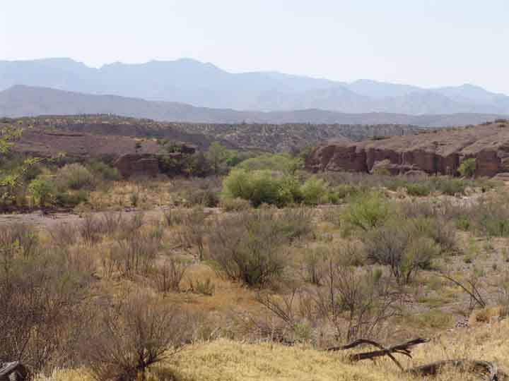
Below are two more comprehensive views of the Redington Narrows photographed from further upstream in April 2005, when the riverbed was dry at this point (click on each image below to enlarge it.):
 ...
...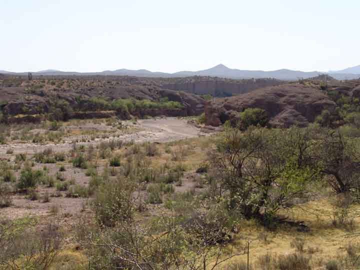
From the vantage point above, the effects of the 1983 and 1991 floods on the river floodplain can be seen. Beyond the first terrace above the floodplain (which is visible in the near foreground of each image), the floodplain was almost entirely scoured of vegetation here, including the whole expanse from left to right upstream from the bottleneck of the Narrows.
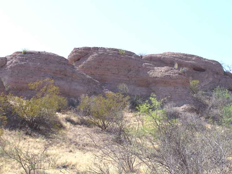
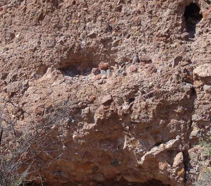
As you can clearly see, a band of hard reddish-gray rock straddles the river at this point. This is a Lower Miocene deposit of sedimentary rock called the San Manuel Formation (see Geology of Hot Springs Canyon for more details on this Formation); at this particular location it is distinguished as the "Soza Canyon facies", and contains a high frequency of volcanic clasts in its tilted sediments, as can be seen below: at left, a broad view of the strata; at right, a closer view of its components. Click on each image below to enlarge it.
 ...
...
Further downstream, near Milepost 32, right at the Cochise County-Pima County line, the old, high terrace above the River has produced a remarkable vegetation: (click on the image below to enlarge it.)
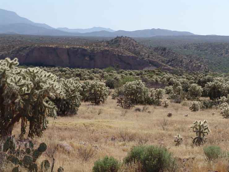
On this high and dry terrace, the dominant vegetation (aside from the grasses) all the way to the terrace's cliff edge is Jumping Cholla. For more details, see Cacti and/or scroll down to Cholla.