The Town of Pomerene and Alternative "K"
This hamlet is partly occupied by descendants of the Mormon Battalion, a nineteenth-century branch of the Iowa infantry mustered in 1846 during the Mexican War, who marched up the San Pedro River on their way toward Tucson (then part of Mexico) and encountered the environmental wonders of the place. Near the Benson Narrows, they were accosted by a herd of stampeding wild cattle, with the reported result of ten to fifteen bulls killed, two mules gored to death, and three men wounded. See "The Battle of the Bulls", which includes this beautiful picture taken somewhere near the site of the battle (south of the Narrows). Thanks to The Religious Education Image Archive, accessible at the link just provided.

We mention this episode not for purposes of humorous diversion, but to note that, as Webb, Leake, & Turner observe in their monumental book The Ribbon of Green (U. of Az Press 2007), the episode reflected the large herds introduced from Mexico by homesteaders in this area after 1832, followed by intensive raiding by Apaches which caused abandonment of the large ranches around 1840. Since the Apaches selectively culled cows, the large wild herds remaining in this area at the time of the Mormon Battalions were bulls -- a very dangerous herd of wild animals indeed. (Webb, Leake, & Turner note that they were gone from the area by the 1850s. See p.223.)
We hope to insert more history of Pomerene into this space as becomes possible, and would of course welcome Pomerenians to contribute to it.
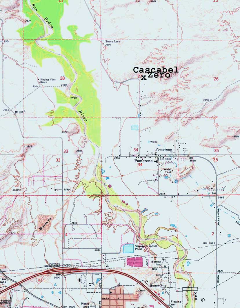
 Exactly how Alternative "K" would run in relation to Pomerene is unclear to us on the basis of the map. Existing Pomerene Road (see it running north at lower far right on the map far above) is the main existing route to Cascabel Road (not visible here, but click on that map for a more focused image and you will see how it runs north from the west-central portion of Pomerene, then makes a sharp left turn beside the "X" that marks the spot of Cascabel Road Milepost Zero. From that point, the Grand Bridge, an ADOT archaeological monument, is about 5 miles drive up a winding, twisty, climbing road. We believe that ADOT would sacrifice to history this monument of their previous endeavors, and circumvent it by running the Highway through the mostly private lands of the floodplain.
We hope the farmers and other residents of Pomerene are actively questioning the ADOT Planners on these matters.