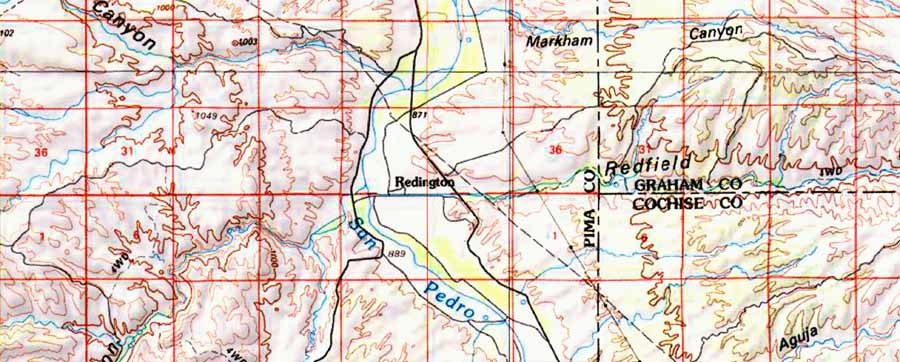
At Redington (see map below), two large wash corridors meet the San Pedro to produce a wildlife crossroads -- Buehman Canyon running from the Catalinas and Redfield Canyon from the Galiluros. These both form deep canyons in their higher reaches and have perennial waters upstream.
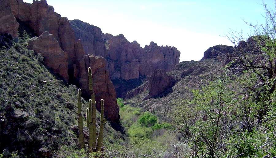
The Bingham Cienega Nature Preserve, located in this significant wildlife corridor in upstream portions of Buehmann Canyon, contains a spring-fed marsh which supports distinctive riparian plant communities and serves as an important oasis for migratory birds. Redfield Canyon is a deep, narrow red-walled vertical gash through Galiuro Volcanics rocks.Perennial waters may be found in its side-canyons, and the 6,600-acre Redfield Canyon Wilderness is centered in the area where the Canyon makes its westward bend descending from the high Galiuros further north.
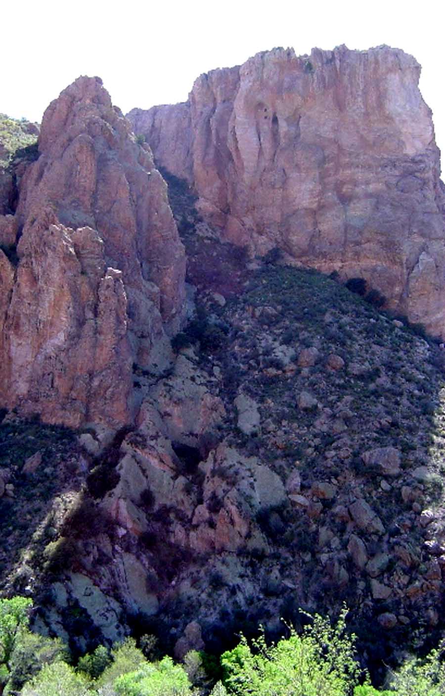
Redfield Canyon is a geological gash of stunning beauty. Red Galiuro volcanics are on display with a stark vividness probably not seen elsewhere.
According to long-time Cascabel resident Mary Taylor and later resident Nathan Sayre, the first documented Anglo-American settlement occured here in about 1875, when Henry and Lem Redfield established a residence, as did Mexican-American Antonio Soza at about the same time. These representatives of two distinctive American cultural traditions both drew other settlers (the early majority was Mexican-American) and eventually gave their names to major locales in the vicinity. Both groups pursued mainly subsistence farming/ranching and traded their produce occasionally over the Cebadilla Pass to Tucson. (The Cebadilla Pass was later renamed Redington Pass.)
(Click on the image at left to enlarge it.)
Aerial photography of the Redington corridors (below) shows both similarities to the Cascabel Core (the multiple long-legs spiralling in-and-out) but also differences (the broader, more open floodplain and the lesser depth of dendritic wash-cutting running in from the uplands).
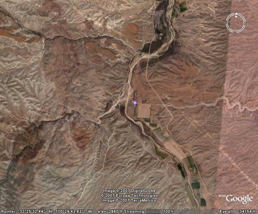
There is quite a lot of private land in the Redington corridor, and land as comparatively open and flat as this would be a tempting location for an off-ramp connecting truckers to rest stops, gasoline stations, cafes, etc., and this would stimulate a township development. ADOT planners might protest that the route is intended to lack such features, but we would regard such affirmations as nothing more binding than that. Some local residents might like this prospect, but we believe that most would not.
The Redington Pass Road, which crosses the saddle linking the two great granitic pillows (plutons) of the Catalina-Rincon Metamorphic Core Complex renown to contemporary geologists, can be seen running out of the bottom-left-central portion of the map above from its connection with Cascabel Road some distance north of Redington Central. (The massive Redington Bridge, the northern manifestation of the Grand Roadway Project discussed above, is located a short distance south of the intersection.
The Redington Pass Road is now a little-traveled if scenically unforgettable dirt-road linking this corridor crossroads with the Tanque Verde Road at the western edge of the Rincon Mountains in the eastern outskirts of Tucson. If a major Interstate Highway were to pass through Redington, strong pressure would no doubt arise to provide that off-ramp, and then to pave this rural dirt road (with major consequences for the distinctive biome to be found here.) For more details on the richness of this important transitional ecozone, see this side-page:
Side-page: Vegetation Communities of the A-7/Bellota Ranch/Redington Pass Area
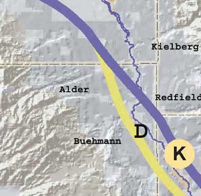
Now consider the locations of Alternatives "D" and "K" with reference to the Buehman-Redfield Corridor just briefly described. Alternative "K" would run directly across the mouth of Redfield Canyon at the 3-corners intersection of Cochise, Graham, and Pima County,
Alternative "D" would in this drawing run across the terraces of lower Buehman Canyon.
People who know these canyons better than we do should assess what massive roadway construction would involve here, but neither Alternative looks very attractive from either an ecological or pocket-book-economics point of view.