The Upper San Pedro: including Sierra Vista Sub-area
[ From Mexico to the Tombstone Gaging Station near Fairbank ]
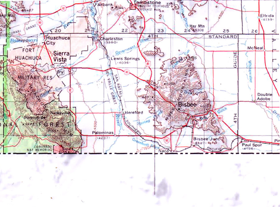
In this part of the drainage, the immediate flanking Sky Islands are the Huachuca Mountains (much of which is National Forest) and the Mule Mountains. While we cannot pretend to detailed understanding of the Upper San Pedro Watershed (see below for links directing viewers to some relevant sources), we do intend to explore ecological relationships between the river corridor here and its main flanking Sky Islands. Toward developing that aim, see this link: Huachuca Mountains (and for the vegetation-stacking features of Sky Islands, see that link).
Part of this Upper (southern) area of the river was designated The San Pedro Riparian National Conservation Area (SPRNCA) in 1988. The SPRNCA straddles the northern end of the Sierra Vista Subarea and the southern end of the Benson Subarea. For some details on bird conservation activities in this part of the river valley, see this link: Southeastern Arizona Bird Observatory (SABO). For an excellent overview of the many agencies concerned with the area, see this link: Upper San Pedro Partnership (USPP). See also Friends of the San Pedro (FSPR), a non-profit organization that supports the work of the SPRNCA.
While the entire stretch of the river contains numerous historical and archaeological sites, this southern portion is internationally known for its Paleoindian sites dating to the end of the Pleistocene Epoch. See Clovis and Murray Springs for a few details. The plants and animals living here during late Pleistocene times were very different from those present today, as suggested by this image below. See Pleistocene Megafauna extinctions, and The Clovis/Folsom Transition.
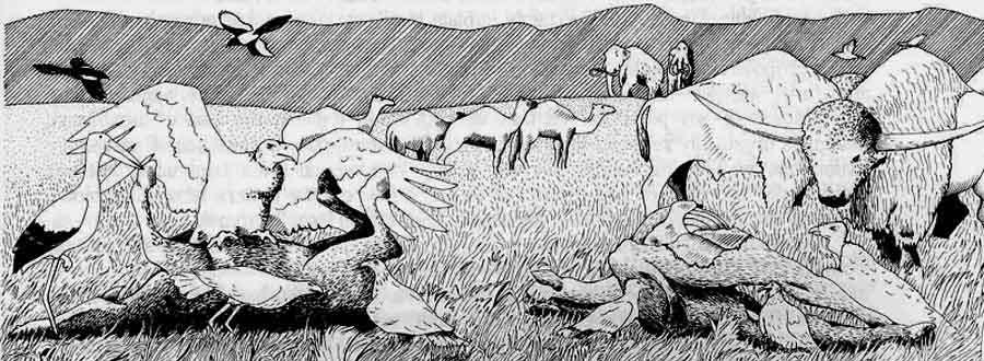
(Image adapted from Steadman, DW and Martin, PS, "Extinction of Birds in the Late Pleistocene of North America" In Quaternary Extinctions: A Prehistoric Revolution, Martin PS and Klein RG. editors, Univ of Arizona press, Tucson, 1984.]
For a general outline of the archaeological history of the river, see Archaeology of the San Pedro River Valley.
.........................................................