Any one equipped with a sense of the importance of history to our understanding of the present and future (not to mention the past) will appreciate that along what is now the Cascabel Road (the sole current route running up the east side of the river from Benson to San Manuel) one may see major evidence of previous human efforts to alter the landscape quite drastically. Follow briefly with us enroute toward Cascabel on this road in order to observe this historical evidence.
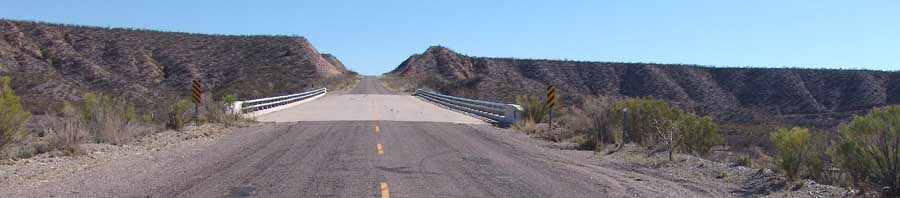
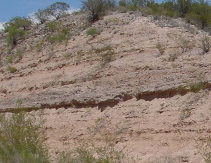
While the River flows in roughly a north-northwestwardly direction out of Benson, North of Pomerene Cascabel Road turns northeastward and rises fairly steeply out of the floodplain, past flat sedimentary layers of the St. David Lake Formation, where at the top of the highest terrace nearly 5 miles out of Pomerene it turns northwestward into a very large road cut. Below: In one of the two massive, freeway-like road cuts that bracket a very substantial bridge placed across Tres Alamos Wash (see more below!), you can observe a closeup example of the old St. David Lakebeds (between milepost 4 & 5). Click on the image below for a closeup.
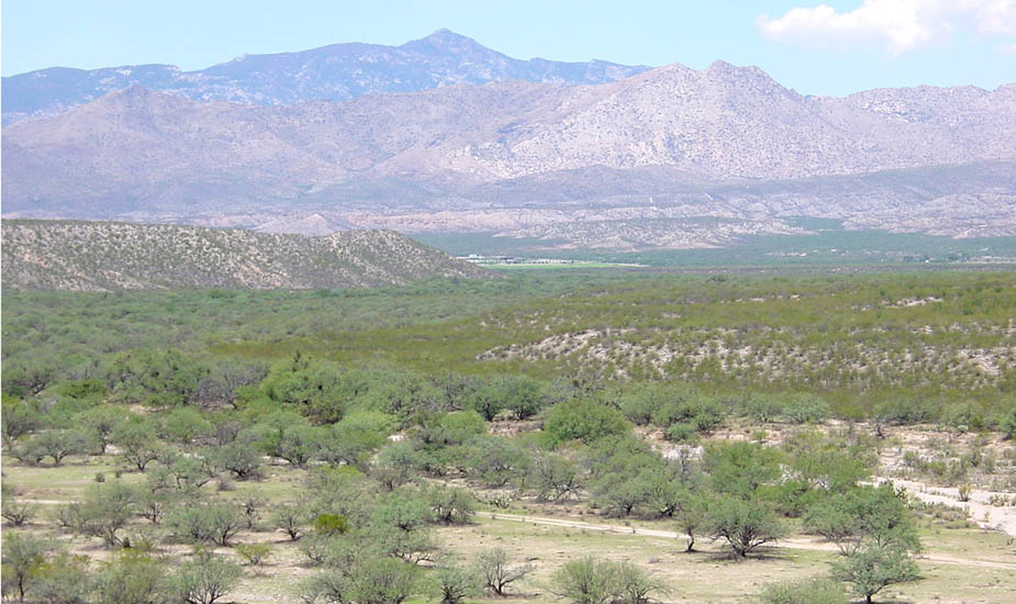
Below: Tres Alamos Wash (North of Benson), viewed from a standpoint close to the "Grand Bridge" of southernmost Cascabel Road near milepost 5, looking West towards the River confluence (July 2002):
ADOT History: A Previous Effort to Build a Very Large Roadway Here
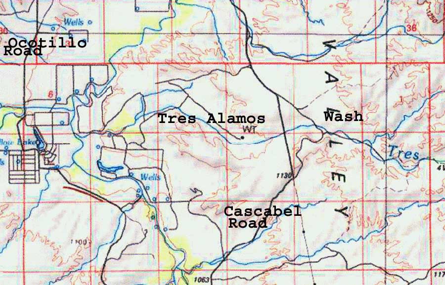
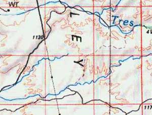
This map below shows how the Cascabel Road (at right-center of the image) bisects the Tres Alamos Wash (which runs from east to west into the San Pedro here, coming from its sources in the Galiuros and Winchester Mountains. Note the unusually arrow-straight NNW-SSE line of the road along this stretch, and also the map-projected straight line extending that line further south-south-eastward. At the far left of the map you can also make out a portion of the Ocotillo Road, which runs generally northward from Benson along the west side of the River.[Maps in this text are adapted from TOPO!.]
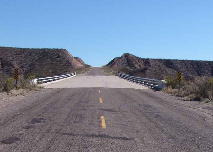
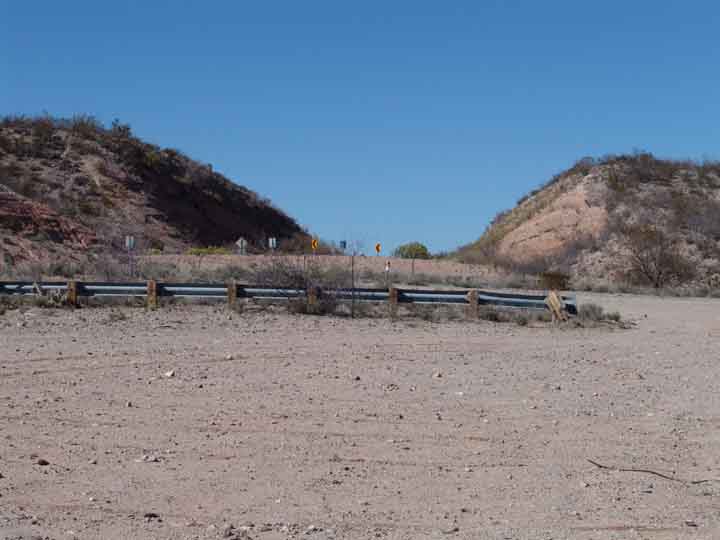
In the late 1980s, the Cascabel Road was a dirt road where it crossed the Tres Alamos Wash, but incongruously it contained these very large road cuts shown below, associated with the large and rather expensive bridge which had been built across the Tres Alamos Wash. These images show, at left, a view of the bridge, the arrow-straight road and the two grand cuts taken from the north; at center, the southermost cut viewed from the south end of the construction zone (the existing Cascabel Road enters the cut from the middle-left of the photo, turning sharply into the cut as you go north); at right, a view from the north looking toward the projected road's southern direction, which until recently had a sign proclaiming "Road Closed". Now only a remnant remains. Photos taken in March 2004. Click on each image to enlarge it.
 ..
.. ..
..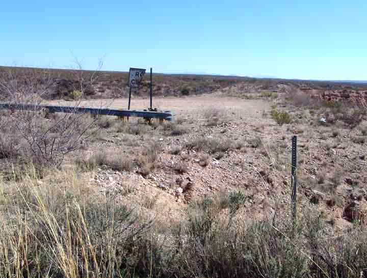
 Since beyond this sign toward the south the land drops away abruptly in a series of deep ravines running nearly perpendicular to the apparent target of the road -- U.S. Highway I-10 some 7 miles to the south -- the prospect of building a road further in that direction would seem very daunting indeed (not to mention that of cutting similar gashes through the various lands further north). One understanding (not at this point confirmed by us) relates that in the late 1970s some members
of the ADOT pushed this project into construction in order to provide a better and shorter link between the San Manuel mine and smelter and other mines located along the Mexican border. The project foundered in conflicts over funding, with recognition of the ruinous costs that would be incurred in order to complete it, and with "issues of drainage". The lower portion of the topo map (at left) still indicates the wishful projected direction of a road extension aimed at I-10 in a straight line toward the south-southeast across what is on the ground an array of cross-cutting, bridge-demanding washes.
Since beyond this sign toward the south the land drops away abruptly in a series of deep ravines running nearly perpendicular to the apparent target of the road -- U.S. Highway I-10 some 7 miles to the south -- the prospect of building a road further in that direction would seem very daunting indeed (not to mention that of cutting similar gashes through the various lands further north). One understanding (not at this point confirmed by us) relates that in the late 1970s some members
of the ADOT pushed this project into construction in order to provide a better and shorter link between the San Manuel mine and smelter and other mines located along the Mexican border. The project foundered in conflicts over funding, with recognition of the ruinous costs that would be incurred in order to complete it, and with "issues of drainage". The lower portion of the topo map (at left) still indicates the wishful projected direction of a road extension aimed at I-10 in a straight line toward the south-southeast across what is on the ground an array of cross-cutting, bridge-demanding washes.
Side-page: more details & historical/current implications of this "Grand Cascabel Roadway"