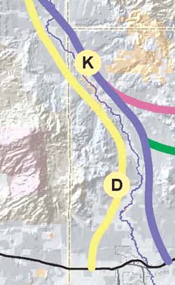
ADOT Alternatives "D" and "K" in relation to this Sub-Area
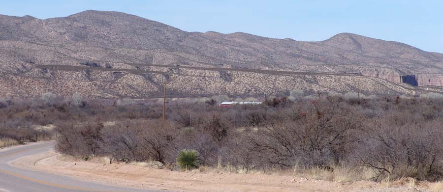
Around Milepost 15, the Three Links Road meets the Cascabel Road. The former is marked (at least approximately) as "Alternative B" in the ADOT plan, and forms a fairly substantial roadway that crosses The Allen Flats (north of the upper reaches of the Tres Alamos Wash and northwest of Willcox). We will not discuss issues concerning this roadway here, but the image below (taken in March 2005 from the terrace south of Kelsey Canyon and looking toward the southwest) draws attention to the mountain structures west of the river and north from the latitude of the Benson Narrows:
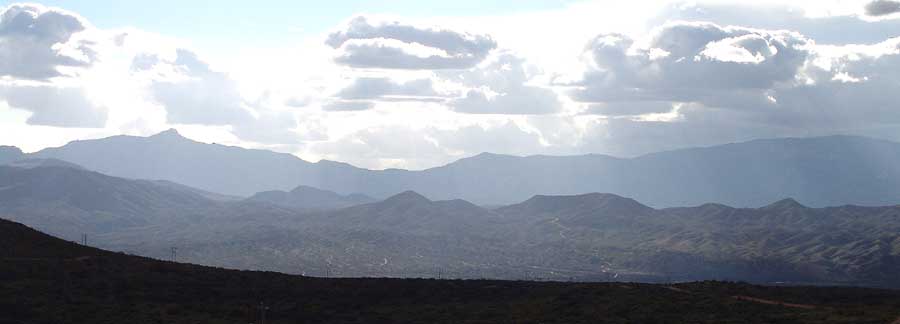
Beyond the dark terrace structure in the foreground and directly above it lie two long stretches of the Little Rincon Mountains. In the lower middle foreground is the lower, eastern portion of the Little Rincons, which extends roughly northward from the lower drainage of Ash Creek (fed by Rincon Peak and its hig environs in the left background) all the way to Cascabel.
On the map below, "x" marks the spot (very roughly) where the picture was taken. Now we draw our attention back to ADOT Alternative D, shown in yellow paralleling the river on the west side.
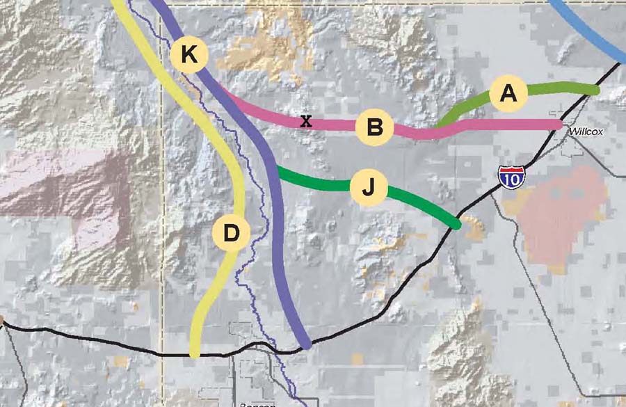
"D" Parallels (or perhaps potentially merges with) Alternative Route "K"
I-10 Bypass alternatives "D" and "K" appear to merge very closely in this area. It would appear that their separation along this stretch is mainly dictated by requirements of map illustration, and that the Planners really intend to draw the road into the floodplain. Whatever their intentions, roadway options increasingly narrow here like a funnel, and both alternatives must increasingly follow the line of the riverbed unless the Planners have really Grand Roadways in mind here..
to the west of "D", this map clearly shows both Happy Valley and the fault-driven north-south escarpment that runs from Mica Mountain to the south side of Rincon Peak. The large expanse of Happy Valley Basin shows with particular vividness in this image. Paige Wash is also clearly visible swinging north from the basin, while Hot Springs Canyon runs into the upper ball of the "K".
Teran Wash is shown bisecting the eastern Alternative just above the merging of the red and blue lines. Not so readily visible is the Kelsey Corridor, which is better seen in the map below left.
Consider west-side Alternative "D" at this point
Below, near Kelsey Wash at Milepost 17, a much older series of pale misty-rose-colored vertical cliffs also flank the River. Judging from the geology map in Dickinson 1991, the more vertical cliffs to the left are probably a Paleozoic marine formation, while the more conical cliffs on the right are probably Paige [San Manuel] Formation. (Click on the image for a close-up view.)
At this location,one might think that the west side of the uplands continues to constrict any potential "D" route into the floodplain.
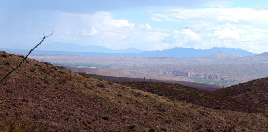
Below, looking down on the same cliffs (at lower right) from the Pool Wash Ridge Road near Sierra Blanca, a vantage point about 600 feet in altitude above the River. The Paleozoic marine formation (?) stands out prominently at lower middle-right, while the Three Links Farm flats are the green area at far middle-left of the photo. (Huachuca Mountains hazy-blue at far upper left toward the south, Whetstones the darker-blue mountains at right-middle.)
Near Milepost 16, a series of hanging Quiburis-era terraces flank the west bank of the River:
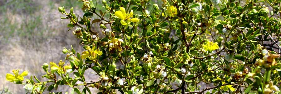
The surfaces of most of these terraces above the river are dominated by a major shrub of our three North American deserts: Creosotebush -- see this link for details on this very important plant [sacred to the O'odham, host to numerous distinctive other plants and animals).
At this point, the bajadas running down from the Little Rincons close in the valley, and one might therefore assume that the yellow-pen depictions of the "D" Alternative shown above as running along the uplands away from the river should be regarded as nothing but a pictorial device. If the planners of this alternative are thinking at all realistically, "D" at this point would necessarily ride the floodplain.
However, in what follows below we intend to think both from the perspective of what we as opponents would assume to be "realistic" in any ordinary (if wantonly destructive) sense of that term, and also from the perspective of someone who would spare no expense (the Interstate-supporting agencies of the Federal Government would mostly foot the bill, are we right?) to build a San Pedro Valley Interstate here. In that spirit, let us look at this location from the perspective of one who would build a freeway on the uplands shown west of the river above regardless of any cost.
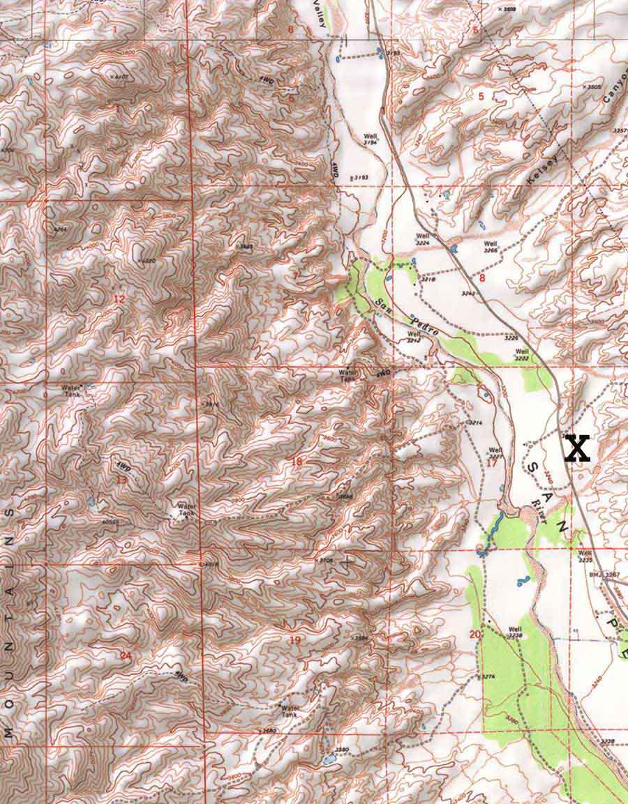
Very roughly speaking (because here photo detail is a secondary matter), the location of the previous photography at Milepost 16 is marked with a tiny black "X" in the lower-right quadrant of the image at left. If we take the mapped Alternative "D" literally (as just postulated), it should run roughly north-south over the uplands west and northwest of the river at this point. It looks like an exceedingly difficult route, but perhaps the planners would prefer to rise up to the ridgeway of the Rincon Mountains here. This might be possible at some point, but not at the far northern end where these mountains decay down into Cascabel (see further along on the main page). Alternatively, the route might be run down Paige Wash. (See Side-page: Happy Valley & Paige Canyon Corridor.) Let us suppose here that the uplands just west of the river are the prospective route.
The discussion should now descend to a less distant level. Click on the image for a close-up map of this area.
Again, an "X" (roughly) marks the spot on this close-up version of the map near where the above photograph was taken. Imagining vertically smaller but horizontally much wider versions of the "Grand Bridge" described above on the main page (and a great many of them) -- would anyone thinking realistically believe that, in terms of efficient road construction (as opposed, perhaps, in terms of much more grandiose visions), building a freeway with bridges across every one of these these ravines would be a good idea? (Click on the map image for a close-up view.) And a ridge- and down-Paige Canyon route would require some heavy construction stilt-roadway. (The word "preposterous" keeps rising to mind regarding road-construction across any part of this topography.)
At the point of the photograph image above (of the hanging terraces, taken from the perspective of Cascabel Road on the east side of the river), Alternatives "B", "K", and "J" have joined, the merged Alternative now being labelled as "K". Let us now look briefly at this east side of the river.
Consider East-side Alternative "K" at this point
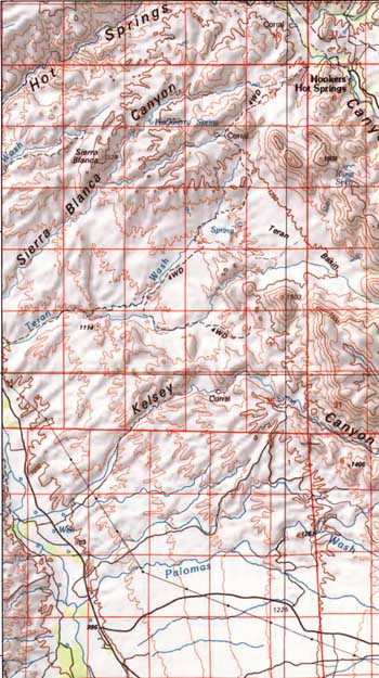
Previous photo location is along the Cascabel Road at lower left. Again, if we assume a literal interpretation of the ADOT's Alternative map routes, "K" would avoid the river floodplain and pass across the uplands shown at left. (We assume they are not speculating about a route that would take them through the Allen Flats -- eastward out of view on this map, but see the map further below on the main page -- and thence through the Muleshoe Nature Preserve, whose Hookers Hot Springs headquarters arejust visible in the upper right).
Assuming then intent to avoid the river floodplain, this route -- while not so radically dissected all along the route as that of the western flanks -- confronts not one but three massive canyon systems, each of which may be seen on the map at left.
Note that so far in our discussion of Alternative "K" issues we have bypassed Sierra Blanca Canyon (shown flowing to the river from far upper-right in the mapjust above). While it's true that casual motorists driving along Cascabel Road not far from Milepost 22 might readily miss seeing it entirely if they were only slightly distracted by bird-watching or whatever, this too is a large and dissecting structure throughout its length further upland. Minor bridging would do for Alternative "K" at the Cascabel road confluence, but upstream requirements would be quite another matter. See the accompanying side-link for all a transportation planner might care to learn about this very interesting, beautiful, ecologically valuable wash:
Side-page: Geology Trip up Sierra Blanca Wash